
If you’ve ever waded into the Pacific off Northern California in the middle of summer, you already know the water there doesn’t much care what month it is. A big part of the reason is upwelling.
It’s a fairly simple bit of physics. Wind pushes the top layer of the sea away from the coast (the Earth’s spin bends that push, but that’s a whole other article), and water from down below comes up to take its place. NOAA says that deeper water’s typically colder. Your ankles tend to find that out first.
But water coming up from the bottom can bring more than a chill. In the Baltic Sea, the bottom layer tends to be saltier than the water on top, the two don’t mix easily, and that bottom layer can end up short on oxygen.
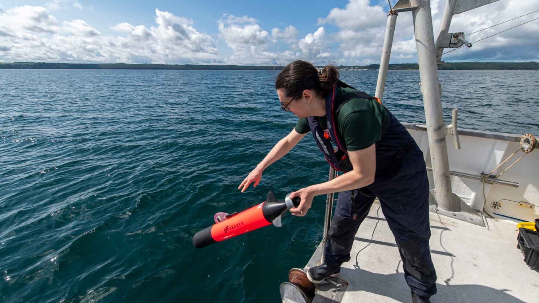
At the end of August, oceanographers from a German institute and an Estonian university had a 21-pound drone in the water off Germany’s Baltic coast when some of that bottom water came all the way up to the surface.
So what were they doing out there?
Testing, mostly. From August 25 to 28, Michael Naumann of the Leibniz Institute for Baltic Sea Research Warnemünde (IOW) worked off the institute’s workboat Klaashahn with Taavi Liblik, who heads the marine physics division at Tallinn University of Technology (TalTech). The drone belongs to TalTech. They covered a stretch of coast near Warnemünde that runs from Elmenhorst and Nienhagen to Heiligendamm. The University of Rostock’s research vessel Limanda went along too, with a crew under Peter Holtermann, a marine physicist at IOW.
The team ran the drone along lines about 1.9 miles long, straight out from the Elmenhorst shoreline to the anchorage where cargo ships sit and wait. On each run it dove to the seafloor, swam back up to the surface and did it again, so it moved through the water in a long wave pattern and took temperature, salinity and oxygen readings at every depth along the way.
That rollercoaster path is a pretty smart way to do it. If you lower an instrument over the side of a boat, you’ll get one column of numbers from one spot. Send a drone porpoising along a line and you’ve got a whole slice of the sea from top to bottom. It’s also a different trick from the 6.5-pound drone we covered recently, which sprints across the surface and stops to dive straight down for each reading.
They did the one-spot version too. While the drone ran its lines, the researchers measured the same three things by hand with a CTD probe. CTD stands for conductivity, temperature and depth, and it’s basically the go-to instrument oceanographers lower over the side on a line (conductivity is how you work out salinity). With both sets, IOW can check the drone’s numbers against a tool it already trusts.
Then the wind came out of the east
An easterly wind started blowing on Tuesday, August 25, the first day of the campaign. That stretch of German coast runs more or less east to west, so a wind from the east blows along the shore. NOAA calls that the ideal setup for upwelling.
By Thursday, oxygen-poor water from the deep had made it to the surface, and the drone caught that saltier water from the bottom coming up close to shore. IOW says the oxygen bottomed out at 3 to 4 milliliters per liter of seawater, and it puts the level that starts harming marine life below 2. So this one stayed on the safe side of the line.
That’s pretty good news for whatever lives on that patch of seabed. It’s also frankly pretty lucky timing for a trip IOW billed as an equipment test, because you can’t schedule the wind.
There’s a good reason IOW keeps an eye on this. The institute says shallow Baltic coastal zones get hit by oxygen loss and warm water on a regular basis, and that can end in fish kills and toxic algae blooms.
IOW also says that between the drone, the Limanda crew and a set of moored stations, it can study this upwelling in more detail than it ever could before. That includes how the wind moved the water around. A moored station’s basically an instrument anchored in one spot that keeps logging around the clock. Put a few of those next to a drone slicing through the water and you’ve got both the when and the where.
Why send a drone instead of a boat?
Because it’s a pain working the shallow strip of sea along a coast. IOW says small boats and divers can often only work there when the weather cooperates. A small drone still needs someone nearby, but it’ll run its lines on its own.
The usual science robots don’t help much in there either. According to a paper Liblik and his TalTech colleague Fred Buschmann published in Frontiers in Marine Science in March, underwater gliders can’t operate in water shallower than about 98 feet, and water that shallow covers roughly a third of the Baltic.
A glider is a drone that sinks and rises on small wings instead of running a propeller. The robot floats scientists drop into the open ocean are even worse off, since they’d just run aground.
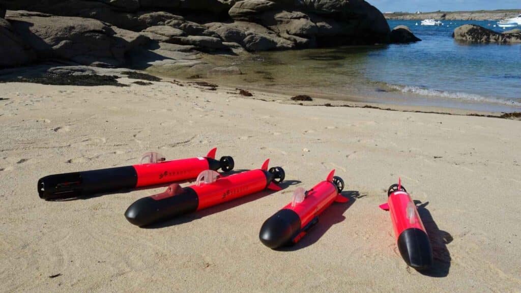
The paper says TalTech’s drone is nimble enough to work in that kind of water. IOW’s write-up only calls it a SEABER vehicle from France, but every spec it lists matches the YUCO-PHYSICO that Liblik and Buschmann describe, so I’m fairly confident it’s the same machine. It’s about 4 feet long and under 5 inches wide, light and compact enough to launch from a boat or straight off the shore.
It’s had a decent workout already. Last year, Liblik’s team ran it on 11 missions in Estonian waters, from a shallow bay dotted with fishing nets out to the open Baltic. Its temperature readings came within about four hundredths of a degree Fahrenheit of a brand-new reference probe fresh from factory calibration. The team even set it to skim as little as 1.6 feet above the bottom, on purpose, to find its limits, and it bumped the bottom once.
The oxygen numbers still need checking
So how good are its oxygen readings?
We don’t know yet. The accuracy checks in that paper covered temperature, salinity, chlorophyll and how cloudy the water was. The drone didn’t carry an oxygen sensor on those Estonian runs. In August it did. IOW hasn’t said how those oxygen numbers compared with the handheld probe. I couldn’t find the August data published anywhere else, either.
That comparison’s a big part of what the campaign was for. The paper also mentions that an oxygen sensor weighs more than the ones the team used in Estonia, so fitting one means rebalancing the drone.
Then there’s staying in touch with it. The drone doesn’t send its data or position over satellite or cell networks the way a glider does. It talks to a handheld radio remote with a range of roughly 0.6 to 1.2 miles, so someone’s got to be out on the water nearby.
The paper says the team’s planning to add a small satellite tag like the ones used to track marine mammals, in case it drifts out of range. If you’re putting a marine mammal tracker on your science drone, that’s a pretty honest admission of how easy a 4-foot tube is to lose.
IOW posted its write-up on August 28, and it says this was the first time it’s teamed up with TalTech on this kind of work in the western Baltic. It also says there are already plans to do more.