
- 2 MONTHS AGO · ENERGYA 1,590-foot dam of compacted earth in Kentucky sits on limestone that slowly dissolves in water, so before touching the real thing, the Army Corps rebuilt it 57 feet wide and 100 feet long in a Mississippi lab and ran water through the model more than 200 times
- 2 WEEKS AGO · ENERGYA 402-foot earth dam in New Mexico kept letting out just 250 cubic feet per second while up to 52,000 poured in, and its lake rose almost 43 feet in 13 days, catching 470,000 acre-feet as the towns below it flooded from rivers it doesn’t control
- 2 WEEKS AGO · ENERGYA 36-inch release valve had already been opened ahead of the storm at a century-old concrete arch dam outside Prescott, Arizona, and water still poured over the top on Sunday, when runoff at two to three times normal sent more than 4,000 cubic feet per second into the lake
- 2 WEEKS AGO · ENERGYA 566-foot concrete dam that keeps the Mississippi from changing course lost its 67-foot wing wall to a flood that dug up to 55 feet under it, was cut from a 35-foot drop to 22, and Army engineers have now pumped its bays dry to weigh the ground below for voids
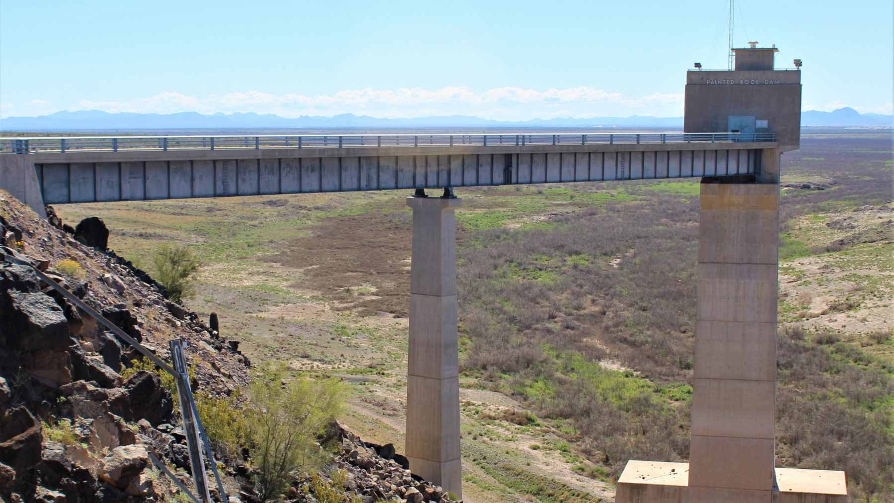
- TODAY · THIS ARTICLEA 181-foot earthen dam in the Arizona desert was holding about 7 acre-feet of water on November 4 and 70,600 five days later, roughly 23 billion gallons of floodwater in a basin that sits dry nearly all the time, and it’s now letting it out at about 3,000 cubic feet a second
When you picture a dam, you probably picture the lake that comes with it. Boat ramps, a marina, maybe a guy on a jet ski doing donuts by the buoys. Painted Rock Dam doesn’t really do any of that.
The U.S. Army Corps of Engineers runs it on the Gila River, about 20 miles northwest of Gila Bend, Arizona, and it’s been in full operation since April 1959. The Corps’ Hydrologic Engineering Center, writing about the reservoirs in its South Pacific Division, didn’t dress it up: “This project is dry nearly all the time.” On November 4, the Corps’ own hourly data had about 7 acre-feet of water sitting behind it.
By the morning of November 9, it was holding 70,600 acre-feet.
So what happened?
If you read our piece earlier this month about the 308-foot dam that sent a flood down the Salt River through Phoenix, you’ve already met this storm. The Salt runs into the Gila, the Gila runs into Painted Rock, and that means at least some of the water Phoenix watched go by is the same water that ended up behind this dam. Basically, this is the second act, farther down the same river system. And since November 10, the Corps has been letting it back out.
So why build a dam that sits empty?
Painted Rock is a flood-control dam, which is a pretty different animal from the reservoirs you see on postcards. Its job is to catch a flood, hold onto it, and let it go slowly enough that the river below doesn’t jump its banks. It isn’t there to store water for cities or farms, which is why it spends most of its life with nothing in it.
That’s a bit of an odd job description if you think about it. You build a huge wall in the desert, and in a good year you barely need it.
And it’s a big wall. The fact sheet the Corps’ Los Angeles District publishes for the project lists an earthen dam 181 feet tall and 4,780 feet long, with a spillway that sits apart from the main embankment and outlet works that run through a circular conduit. Congress authorized it in the Flood Control Act of 1950.
It’s also the last line before the Colorado. The same Corps document describes Painted Rock as the final reservoir on the Gila before it meets the Lower Colorado, and the Gila’s watershed as a whole covers about 50,000 square miles, much of Arizona. Painted Rock sits near the bottom of all that. The document also notes that Painted Rock is the one project in the district that’s ever spilled, meaning water has gone out over the spillway instead of through the outlet. It doesn’t say when.
The lake went up almost 37 feet in five days
If you don’t deal in acre-feet every day (and I’m guessing you don’t), here’s the short version. One acre-foot is the amount of water it takes to cover an acre of ground a foot deep. That works out to about 326,000 gallons, so 70,600 acre-feet comes to roughly 23 billion gallons.
Most of it showed up in one go. The Corps’ data has the reservoir at about 7 acre-feet at the end of November 4 and 43,437 acre-feet at the end of November 5. It kept climbing for four more days and topped out at 70,600 acre-feet at 10 a.m. MST on November 9.
The water surface sat at an elevation of 535.0 feet on November 4 and reached 571.9 feet at that same 10 a.m. peak, so the lake got almost 37 feet deeper in five days.
One caveat. These are hourly, provisional numbers from the Corps’ water management system, which you can check yourself in its public storage data for Painted Rock, and they can still be revised. I’d be pretty surprised if the big picture changed, though.
We saw a lake fill fast in New Mexico last month too, when a hurricane’s leftovers tripled the lake behind a 301-foot dam on the Rio Grande. But that’s a storage reservoir that badly wanted the water. Painted Rock is built to hand it back.
Now the gates are open
For the whole fill, the Corps let basically nothing out. Its outflow readings stayed at a quarter of a cubic foot per second or less until the morning of November 10.
The National Weather Service office in Phoenix says releases started at 7:54 a.m. MST on November 10. The Corps’ data shows about 259 cubic feet per second going out that morning, about 516 by midday on November 11, and between 2,840 and 3,026 cfs since November 12.
Cubic feet per second, or cfs, is just a way of measuring how much water moves past a point. Picture a box a foot wide, a foot tall and a foot deep, full of water. Now picture about 3,000 of those going through the dam every second.
Why not open it all the way and get it over with? Well, that’s pretty much the trade-off with a dam like this. Let it go too fast and you’ve just moved the flood a few miles downstream.
The NWS has had a flood warning up since November 10 for the Gila downstream of the dam, covering parts of Maricopa County and northeastern Yuma County. In its latest update, issued at 7:24 p.m. MST on November 13, it said the dam-driven flooding was still going on and put the release at up to 3,000 cfs. The impacts it lists are farm fields and low-water road crossings near the river, and a gauge just downstream was reading a stage of 9.93 feet.
The gauge below the dam has its own problem
There’s also a USGS stream gauge right below Painted Rock, and its numbers look a little odd. Its provisional daily average went from 0.15 cfs on November 9 to 1,890 cfs on November 16, which is well short of what the Corps says it’s sending out.
I don’t think that’s much of a mystery. The Corps’ fact sheet for Painted Rock says the stream gauge downstream of the dam can’t measure flow accurately, because the weir it relies on ended up set too high during a rebuild. Which means I’d frankly lean on the dam’s own numbers here and treat the gauge as a sign the river’s running again rather than a precise count.
So how much is left?
Quite a lot, still. The Corps hasn’t published a timeline for winding the releases down, at least not one I could find, so I can’t tell you when the lake will be gone. From here the Gila keeps heading west toward the Colorado, and I haven’t seen anything official on how much of this water will make it that far.
At 4 a.m. MST on Tuesday, November 17, the Corps had Painted Rock holding 42,937 acre-feet with the water surface at 566.2 feet, compared with 70,600 acre-feet and 571.9 feet at the November 9 peak.
The National Weather Service’s flood warning for the Gila below Painted Rock Dam is set to expire at 11 a.m. MST on Tuesday, November 17, and the most recent hourly reading I could get from the Corps, at 4 a.m., had the dam still letting out 2,998 cubic feet per second.
 A 1.5-megawatt hydro plant dark since a 2023 fire was restarted after what its operator calls a year’s work done in seven days, as floodwater stood about 5 inches from the top of the Michigan dam beside it, and its turbine then passed about 2,500 cubic feet of water a secondEnergy · 2 hours ago
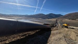 A 48-inch water line has been laid in a trench across the bed of a Utah reservoir drawn down nearly empty for the job, and the falling water gave up a truck stolen in 2007, a hand grenade and a 1915 well still flowing on its own, with the crossing now ahead of its January 1 deadlineEnergy · 3 hours ago
 A 1.8-megawatt wind turbine on a 257-foot tower, with 132-foot blades reaching nearly 400 feet, is one of four to be lowered by crane this fall at Ohio’s first commercial wind farm after more than 20 years, and crews will then excavate foundations about 33 feet deep, due by mid-DecemberEnergy · 17 hours ago