
Reservoirs in the Southwest spend October doing one thing, and that’s dropping. Irrigation season is over, the snow hasn’t started piling up yet, and every water story you’ve read this fall has had the word “record” sitting next to the word “low.” We’ve covered Lake Mead doing it and Flaming Gorge being drained to prop up Lake Powell, and frankly it’s gotten a bit repetitive.
So here’s one going the other way. Vallecito Reservoir, an irrigation lake behind a 162-foot earth dam about 18 miles northeast of Durango, Colorado, held 25,812 acre-feet of water on September 15.
On October 22 it held 93,607. That’s about 3.6 times as much water in five weeks, and it happened in the fall, when the lake’s supposed to be sitting quietly waiting for spring.
Most of it took three dead hurricanes. And the third one, Trudy, pushed enough water down the creeks above the lake on Thursday night that the county told the people living up there to pack a bag.
So how empty was it?
Pretty empty. Vallecito’s full pool is 129,700 acre-feet, so 25,812 is a hair under 20 percent, or a fifth of the lake.
The surface sat at 7,617 feet above sea level that day and the two streams feeding it, Vallecito Creek and the Los Pinos River (the Pine River, if you live down the valley), were together delivering 77 cubic feet per second, or about 35,000 gallons a minute, which sounds like plenty until you see what came next. Southwest Colorado had come through a dry winter and a drier summer, and the irrigation district had drawn the lake down to run its ditches.
If you’ve never dealt with acre-feet, one acre-foot is an acre of land covered a foot deep in water, or about 326,000 gallons. Two average households get through roughly that much in a year, give or take. So 25,812 acre-feet sounds like a lot until you remember the lake was built to hold five times that.
Then the rain started.
The first jump came on September 17, before any hurricane got involved. A storm parked over the San Juans, Vallecito Creek spiked to 2,540 cfs that afternoon, inflow to the lake hit 1,692 cfs, and storage went from 25,887 acre-feet to 29,134 overnight.
At the end of the month the remnants of Hurricane Polo came across the Four Corners, the same system that refilled Elephant Butte in New Mexico, and by September 30 the lake held 54,935 acre-feet, more than double the September 15 figure. Hurricane Rachel’s leftovers came ashore in Southern California on October 10 and crossed Nevada and Utah over the next two days, and Vallecito climbed from 68,549 acre-feet on October 12 to 80,737 on October 17, with inflow peaking at 2,019 cfs on October 14.
By October 21 the lake held 86,275 acre-feet. Which, on its own, would’ve been a decent story about a reservoir having a good fall.
Then Trudy showed up
Trudy never made landfall. The National Hurricane Center issued its last advisory on the evening of October 19 with the storm drifting as a post-tropical low about 160 miles off the Mexican coast near Cabo Corrientes.
What was left of it got pulled north into a slow subtropical system that sat over the Four Corners for most of the week. Brooke Scholtens, a meteorologist at the National Weather Service in Grand Junction, told KSUT it was “a subtropical system and the remnants of Hurricane Trudy,” with two to three inches around Durango and four to five around Pagosa Springs.
The problem for Vallecito is where that rain fell. The homes in the north Vallecito area sit along Vallecito Creek, upstream of the lake, and that’s where the water showed up first.
The La Plata County Office of Emergency Management had set two tripwires on the creek gauge: a pre-evacuation notice at 3,200 cfs and a mandatory evacuation at 4,200 cfs. That’s frankly a sensible pair of thresholds given what happened on the same creek in October of last year, when it hit 7,200 cfs and about 390 homes were cleared out.
The creek crossed 3,200 cfs on Thursday evening and the county put zones 1 through 4 on pre-evacuation at 9:15 p.m., according to The Durango Herald. Projections had it reaching 4,200 cfs around 1 a.m. It didn’t. The USGS gauge on Vallecito Creek peaked at 3,570 cfs at 10:45 p.m., and the Los Pinos gauge above the reservoir peaked at 3,640 cfs at 3:30 a.m. Friday.
The combined flow from the two streams topped out at 7,070 cfs at 2:15 Friday morning, and by around 2 a.m. the county said the creek appeared to be receding. “We’re not out of the woods yet,” OEM Director Rob Farino told the Herald. Nobody was ordered out.
All of that water went into the lake. Reclamation’s daily numbers for October 22 show inflow of 4,143 cfs, the pool rising from 7,649.71 feet to 7,652.73 feet, and storage climbing by 7,332 acre-feet in a single day, from 86,275 to 93,607. The dam’s outlet works were releasing 443 cfs that day, up from 29 cfs two weeks earlier, which suggests the irrigation district had started letting water out the bottom to make room.
So why didn’t a 162-foot dam keep anyone’s house dry?
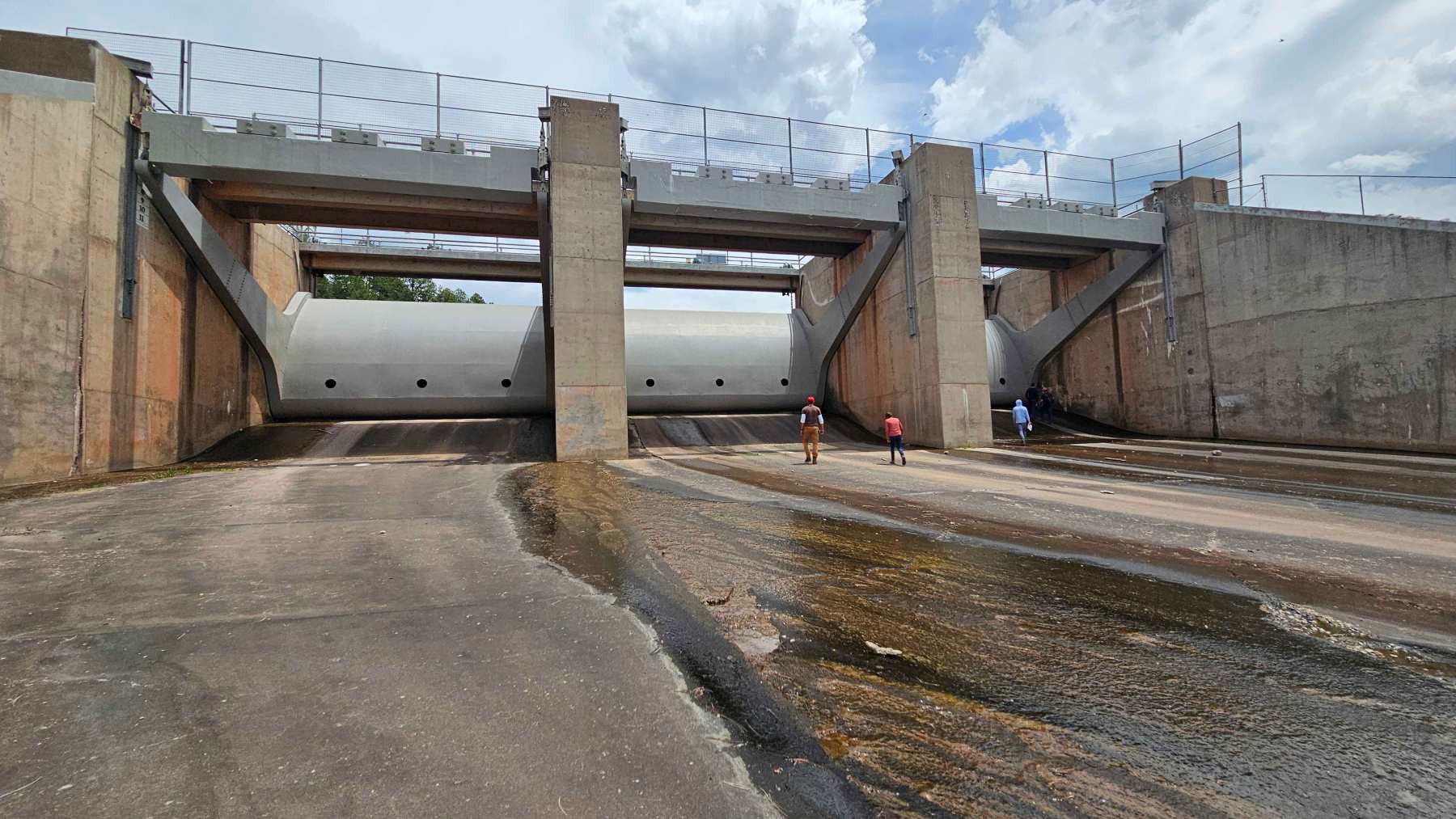
You may be thinking that a dam with that much empty space behind it should’ve made Thursday night a non-event, and the answer is that it did, for everyone downstream. Vallecito Dam is a zoned earthfill structure, 162 feet high and 4,010 feet long, built out of 3,738,000 cubic yards of dirt and rock between 1938 and 1941.
The Bureau of Reclamation’s own description of the project says the reservoir has 125,500 acre-feet of capacity assigned for flood control, and the gated spillway on the right abutment can pass 33,000 cfs. The Pine River Irrigation District runs it. Below the dam, the Pine River through Bayfield and on to the Southern Ute lands got a controlled 443 cfs on Thursday instead of the 4,143 cfs that came in.
A dam can’t catch water that never reaches it. The houses that went on notice are on the creek a few miles above the lake, in the stretch where the water is still a river and not yet a reservoir.
The dam doesn’t get a vote on that. Same thing happened last October, when the creek jumped its levee and wrecked homes in the same neighborhood while the lake downstream filled up nicely.
Which is arguably the more interesting part of this story. The lake behind the dam went from a fifth full to 72 percent full, and the only place the extra water caused real trouble is upstream, where the dam was never going to help.
Meanwhile, downstream
Vallecito’s water eventually reaches the San Juan River, then Lake Powell, then Lake Mead. On the same day Vallecito posted 93,607 acre-feet, Reclamation’s gauge at Mead read 1,037.16 feet, the lowest since Hoover Dam first filled the lake.
Mead set a record low on October 9 at 1,037.60, another on October 15 at 1,037.53, and then just kept sliding, a few hundredths of a foot a day. The old mark, before this year, was 1,040.58 feet on July 28, 2022.
I’d love to tell you the Colorado water helps, but it pretty much doesn’t. Mead held about 6.8 million acre-feet in mid-October, so everything Vallecito gained since mid-September is about 1 percent of what Mead has left, and most of it isn’t going anywhere anyway. It’s irrigation water. The district will hold it through the winter and run it down the ditches next summer.
Is the lake still rising? Probably, but I can’t tell you by how much.
Reclamation hadn’t posted Thursday’s or Friday’s numbers when I checked Saturday morning, and both creeks were still running well above where they started the week, at 1,240 and 1,730 cfs just before 3 a.m. Saturday. Compare that with the 289 and 367 cfs they carried early Wednesday.
The National Weather Service kept its flood warning for La Plata, Archuleta and Hinsdale counties in place until 3:45 p.m. MDT on Saturday, October 24, with another half inch to an inch of rain possible from redeveloping thunderstorms. Reclamation’s last posted reading for Vallecito, from October 22, puts the lake 10,637 acre-feet above where it sat on the same date a year ago.