
At some point this winter, a TV meteorologist near you is going to stand in front of a map of the Pacific with a big orange smear across the middle of it and say the words “El Niño.” That smear is real. But somebody has to go out there and check it with an actual thermometer, and right now that job belongs to four sailboats that don’t have anybody on them.
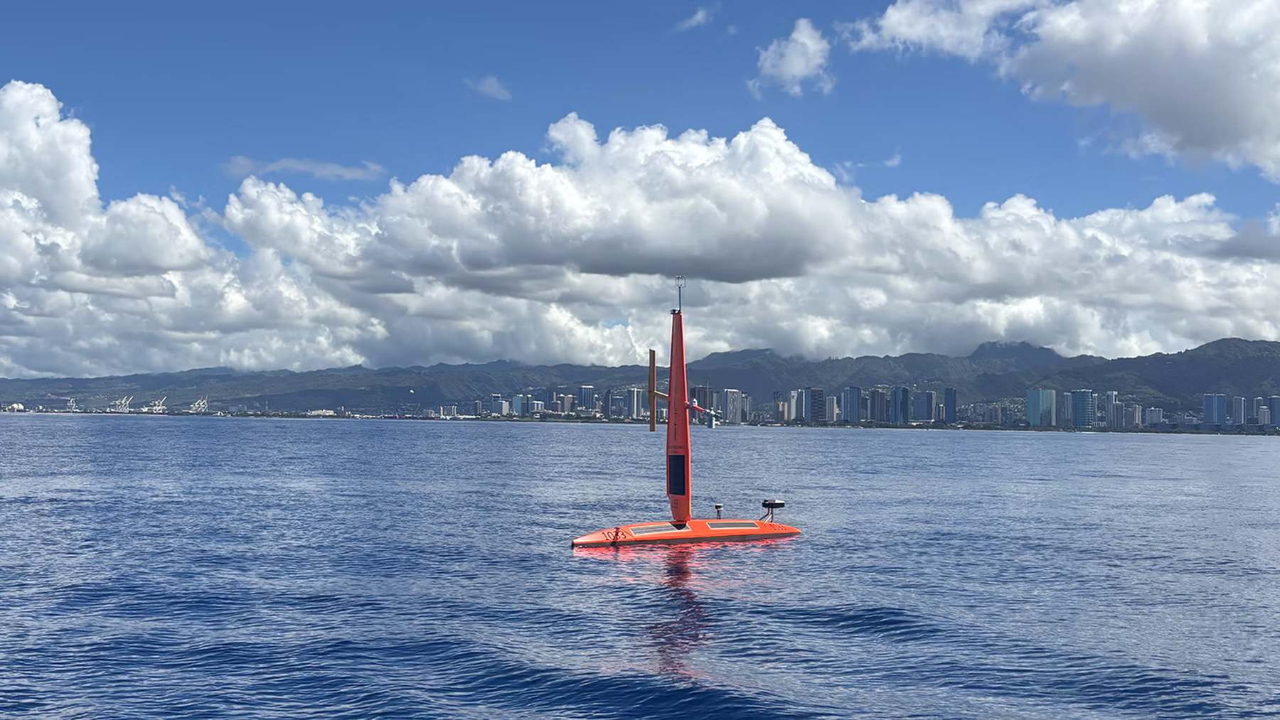
They’re Saildrone Explorers, 23-foot drone sailboats built and run by a company in Alameda, California, and NOAA’s Pacific Marine Environmental Laboratory (PMEL) sent them south out of Honolulu in late August. Their destination is a stretch of the equatorial Pacific scientists call the Niño 3.4 region. It’s basically the box NOAA watches to decide how strong an El Niño is.
According to NOAA Research, the trip down is about 1,500 miles, and the boats are supposed to spend four months out there before they head home. That’s a pretty humble way to keep tabs on what could turn out to be the strongest El Niño since NOAA’s records start in 1950.
The first pair, SD1033 and SD1077, left Honolulu on August 21. NOAA’s own paperwork doesn’t quite agree on when the other two, SD1088 and SD1090, followed. The mission team’s logbook says August 31, while the agency’s announcement says they went out the week before. Either way, all four were on their way south by the start of September.
So what is El Niño, exactly?
You’ve heard the name for decades, so I’ll keep it short. Normally, trade winds push warm surface water west across the Pacific toward Indonesia, while cold water wells up from below along the equator farther east. When those winds weaken, the warm water slides back east, and all the heat it carries shoves the jet stream around and scrambles the weather thousands of miles away.
NOAA calls it an El Niño once the water in that Niño 3.4 box runs at least 0.9°F above normal for a stretch and the atmosphere starts behaving to match.
This one blew past that months ago. In its October 26 update, NOAA’s Climate Prediction Center had the latest weekly reading in the box at 4.5°F above normal, with the water off South America running 7.9°F warm. The agency gives it an 83% chance of becoming a historic event during October through December, which in NOAA-speak means stronger than any El Niño on its books going back to 1950.
Now, one hot week isn’t the same thing as the three-month average NOAA uses to rank these events. The most recent of those, covering July through September, came in at 3.1°F above normal. So nobody’s officially calling a record yet, though the trend’s pretty hard to argue with.
Here’s how the four regions NOAA tracks along the equator looked in that October 26 update, from west to east:
What does that mean for you? Depending on where you live, maybe a soggy winter. NOAA lists heavy rain and flooding across the southern US as one of the typical knock-on effects of an El Niño like this one, along with drought in Australia. The agency’s careful to say a strong event only tilts the odds, though. It doesn’t guarantee anything.
The ocean already has buoys, so why the boats?
NOAA isn’t exactly flying blind out there. The Tropical Pacific Observing System is a mix of moored buoys, drifting floats and satellites that tracks wind, air temperature, humidity and water temperature down to about 1,640 feet, every hour. The catch is that the buoys are anchored hundreds of miles apart.
Satellites cover a lot more ground, but they’re reading the ocean from orbit. Meghan Cronin, the PMEL research oceanographer leading the project, says that’s exactly why somebody still has to dip a sensor in the ocean and check their numbers.
That’s the drones’ job. They log data every minute, a few hundred yards apart, and the scientists steer them straight across the edges where warm water runs into cooler water. Those edges move around, and a buoy chained to the seafloor can’t follow them. A sailboat can.
Before boats like these existed, getting that kind of gear to the middle of the equatorial Pacific meant months of planning, a big research ship and a team of scientists living at sea for months. NOAA says uncrewed boats do the job at a fraction of the cost, although it hasn’t published a price for this particular mission.
What’s on board
All four boats carry sensors for wind, air temperature, humidity, air pressure, water temperature and salinity, plus a current profiler that measures how fast the water’s moving, and in which direction, in the top 250 feet. Water temperature gets read at several depths, from the very surface down to the bottom of the hull about 6.6 feet under, where another sensor also picks up salinity and dissolved oxygen.
Two of them also carry a carbon dioxide sensor PMEL designed itself, and I’d argue that’s the most interesting piece of gear in the fleet.
Normally, the central and eastern equatorial Pacific breathes carbon dioxide out into the air, because cold, CO2-rich water keeps welling up from the deep and releasing gas at the surface. An El Niño slows that upwelling down or shuts it off entirely. How much less CO2 comes out of the ocean this time is one of the things the team wants to measure, and right now they don’t know.
Some of the data goes straight onto the Global Telecommunication System, the network weather agencies use to swap observations, so it can feed into NOAA’s forecast models more or less as it’s collected. The rest gets used to check the satellites, buoys and floats against each other.
These boats weren’t built for hurricanes
The Explorer is Saildrone’s smallest hull. It’s 23 feet long, with a 15-foot rigid wing where you’d expect a sail and a keel that hangs about 6.6 feet below the waterline. Saildrone doesn’t publish a weight, but it’s been reported at around 1,500 pounds. The wind pushes it, solar panels run the electronics, and it can stay at sea for a year or more.
It’s also slow. In a mid-September post on the mission’s logbook, Cronin wrote that the boats were averaging about 1.7 knots on the way down, which works out to roughly 2 mph. “You can walk this fast!” she added. She’s not wrong.
That pace got tested early. By September 4, the first pair, SD1033 and SD1077, had already been forced to swing 180 nautical miles (just over 200 regular miles) off course to get out of the way of Hurricane Lowell, a Category 4 storm. Even on the detour they took 36-knot winds, about 41 mph, and waves of 14.8 feet, and they topped out at 5.5 knots, or a little over 6 mph.
If you’ve read our coverage of the Explorers NOAA parks in front of Atlantic hurricanes on purpose, or the Explorer that crossed a hurricane’s eye through 65-foot waves, that might sound tame. But the hurricane boats run a cut-down wing built for storms. The equator boats don’t. PMEL’s team says these ones were designed to go fast and go long (fast being a relative term here), not to ride out hurricane-force wind, so dodging was pretty much the only sensible move.
And Lowell had company. According to the logbook, Hurricanes Karina and Marie were spinning in the eastern Pacific at the same time, something the team said you very rarely see. More hurricanes in the eastern Pacific happen to be one of the classic side effects of El Niño, so the boats had to sail around a symptom of the thing they were sent to measure.
This is the eighth trip
NOAA and Saildrone have been sending Explorers to the equator for this kind of work since 2017, and this is the eighth mission. The first one, in late 2017, ran into La Niña, El Niño’s cooler opposite. This year the Pacific’s handing them the real thing.
Michael McPhaden, a former senior scientist at PMEL who now works with NOAA’s cooperative institute at the University of Washington, didn’t undersell it in the agency’s announcement. “A monumental El Niño is knocking at the door,” he said.
As for where the boats are right now, the mission’s logbook hasn’t been updated since September 15, when the team said they were close to their next waypoint. At 1.7 knots, covering the 1,100 nautical miles Saildrone counts from Honolulu to the operating area takes about four weeks, so it’s safe to assume they’ve been working the equator for a while. I can’t point to a NOAA update that confirms it, though.
If the four-month schedule holds, the first pair should start the long sail back to Honolulu around the end of the year. Before that, the Climate Prediction Center publishes its next official El Niño discussion on November 12.