
If you’ve ever lost your car in a big parking garage, you’ll know how this goes. You walk straight to the spot where you’re sure you left it. It isn’t there. So you try the next row, then the next level, and before long you’re walking every aisle in the building hoping something looks familiar.
Ocean Exploration Trust (OET) just played a very high-tech version of that game off Wake Island, a tiny US atoll roughly midway between Hawaii and the Mariana Islands. The car, in this case, was a Japanese destroyer that went down in World War II. And the search ended the way plenty of parking garage searches do, with a lot of ground covered and no car.
The nonprofit, which runs the exploration ship E/V Nautilus, posted the results on September 10. Its underwater drone, Hercules, spent 64 hours over two dives looking for the destroyer Hayate. The seven targets the team thought were most likely to be the ship all turned out to be rock.
So why would anyone spend four days hunting one ship that sank more than eight decades ago?
Hayate has a pretty big place in the history books
Mostly because of what Hayate was, and how it went down. It was one of nine Japanese destroyers in the Kamikaze class, and it sailed with the first Japanese attempt to invade Wake. On December 11, 1941, the Marines on the island held their fire until the ships were within 4,500 yards, then opened up with their 5-inch coast-defense guns.
Hayate took the worst of it. An explosion broke the 335-foot ship in two, and it sank almost immediately. According to a background post by Megan Cook, OET’s director of education and outreach, all but one of the 168 men aboard were lost with it, and it was the first Japanese surface warship sunk in World War II.
The invasion force turned back after that, and OET says it’s the only time in the entire war that a Japanese amphibious landing was driven off by coastal artillery alone. As the ships pulled away, Marine fighter pilot Capt. Henry Elrod dropped a bomb on the destroyer Kisaragi, which sank with all 157 men aboard. Wake held out until December 23.
Wake’s seafloor is pretty good at faking shipwrecks
The team didn’t start from scratch. NOAA’s ship Okeanos Explorer had already mapped the waters around Wake, and four researchers (Chris Kelley, Gary Fabian, Hans Van Tilburg and Frank Cantelas) went through that public data looking for anything on the slopes roughly Hayate’s size. They came up with seven targets, and those were the first places Hercules went.
All seven were geology. According to OET, the slopes around the atoll are covered in big carbonate blocks that have tumbled down from above, and some of them are “deceivingly ship-shaped.” On a map made from a ship at the surface, a ship-sized lump of rock and an actual ship can look like pretty much the same smudge.
This isn’t the first time Wake has pulled that trick, either. About 10 years ago, NOAA sent its own robots down to a promising sonar target in that area that scientists thought might be Hayate. It was a shipwreck. It just wasn’t Hayate. NOAA’s team had found a Japanese water tanker called Amakasu Maru No. 1, which a US submarine sank in 1942. They checked two more sonar targets on that dive, and both were rocks.
That’s nine rocks across two expeditions. From the looks of things, Wake’s slopes are pretty much custom-built to waste a wreck hunter’s time.
So how do you search a slope in the dark?
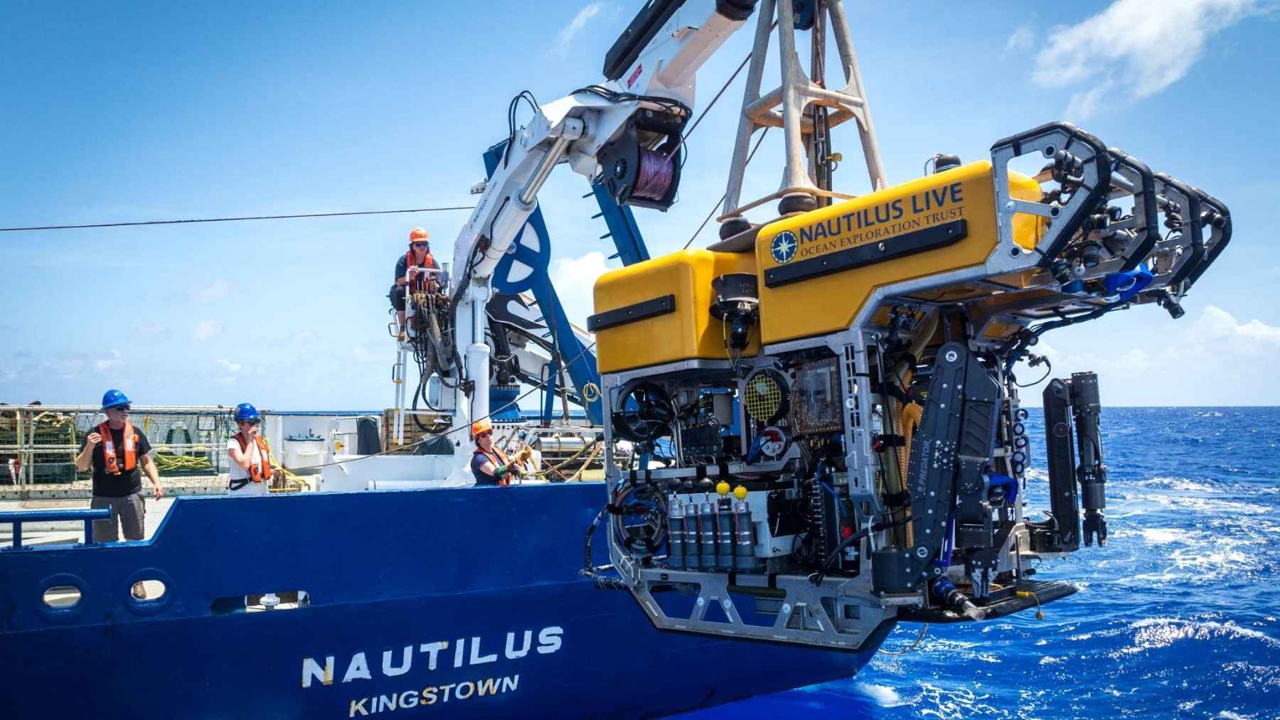
Hercules is what’s called an ROV, or remotely operated vehicle. It’s basically an underwater drone on a leash, flown by pilots sitting in a control van aboard Nautilus through a cable that feeds it power and sends its video back up. If that sounds familiar, it’s more or less the setup on the Irish underwater drone that spent 18 days hunting vents in the Greenland Sea we wrote about on Tuesday.
It’s also bigger than you’d probably expect. The spec sheet for ROV Hercules puts it at 12.8 feet long, roughly the size of a Volkswagen Beetle, and at about 5,500 pounds it outweighs a lot of cars.
The catch is light. Hercules carries a bank of LED lamps, but they don’t reach very far in the deep ocean, and OET says the pool of light its cameras can actually see in is less than 33 feet across. That’s great for filming coral. If you’re sweeping a hillside for a sunken destroyer, it’s not much help.
So the team mounted a Norbit WBMS multibeam sonar on Hercules’ lightbar. A multibeam sonar basically fires a fan of sound pulses at the bottom and times how long each echo takes to come back. Do that over and over while you move, and you’ve got a 3D picture of the terrain without needing any light at all. It’s part of how a 12-foot robot mapped an octopus nursery off California.
This one runs at 400 kilohertz, a high enough frequency to pick out detail on the order of 4 inches. Once the seven targets came up empty, the team switched to what surveyors call mowing the lawn, flying Hercules back and forth in overlapping lanes about 164 feet off the bottom. From that height the sonar covered a strip roughly 490 feet wide, against less than 33 feet for the cameras.
That went on for 64 hours across two dives. By the end, the team had 1.9 square miles of seafloor mapped in a box pattern, and Kris Krasnosky, one of OET’s explorers, has written software that’ll turn that kind of data into 3D models. None of it showed a destroyer.
I went through everything OET has published on the search, and it doesn’t give a depth for either dive. So we know how much ground Hercules covered, but we don’t know exactly how far down the slope it went.
Is Hayate even findable?
I’d say probably, but it isn’t going to be quick. A destroyer that broke in half and sank next to slopes that steep could, in theory, have ended up in two different spots, and the rocks around it apparently do a decent impression of a ship.
Still, I’d argue those 64 hours count for something. Every stretch of slope that’s now mapped at that level of detail is arguably one less stretch the next team has to look at. And the Hayate hunt only took up four days of a month-long trip. The rest went to exploring the deep-sea life and geology around Wake, where OET says the vast majority of roughly 157,000 square miles (407,241 square kilometers) of US-controlled seafloor still hasn’t been mapped.
Who was actually running the search?
A lot of the people involved weren’t even on the ship. Phil Hartmeyer, from NOAA Ocean Exploration, ran the archaeology side from a command center in Alpena, Michigan, at NOAA’s Great Lakes Maritime Heritage Center, working with Kelley Suhre, Andi Yoxsimer and Frank Cantelas. The team also had two Japanese collaborators, Jun Kimura of Tokai University and Hiroshi Ishii, plus more than 100 experts around the world weighing in through the live feed, according to OET.
So a deep-sea survey in the middle of the Pacific was being run, at least partly, from a building on Lake Huron, which isn’t a sentence I expected to type this week. That’s pretty much how this kind of exploration works now, and it’s frankly one of the better arguments for livestreaming the whole thing.
Having Japanese researchers on the call makes a lot of sense, too. OET treats the Wake wrecks as war graves for both countries’ sailors and airmen, and the plan all along was a non-invasive survey that documents a site without disturbing it. The battle killed more than 650 people, including Japanese and American servicemen and Chamorro civilian contractors.
Hayate isn’t the only wreck that’s still missing off Wake. According to OET, five ships, 21 aircraft and a Japanese submarine were lost to the ocean during the 16-day battle, and most of them still haven’t been located. E/V Nautilus’ Wake expedition is scheduled to wrap up September 18.